As the holidays approach, I find myself with a pocket of spare time where I want to try and dive into maps and OBIEE.
Im mainly looking to use google maps with OBIEE 12c.
From what I understand, it looks like I have two options.
I can use mapviewer, and use google maps as a background layer? I did brief research on this but have not dove into it deeply yet.
While researching the above I came across this article that talks about using a narrative for google maps.
https://gianniceresa.com/2016/10/google-map-in-an-obiee-12c-analysis/
Following this it seemed straight forward enough.
I created a Google API key and believe its working correctly (tested it using google samples and jsfiddle)
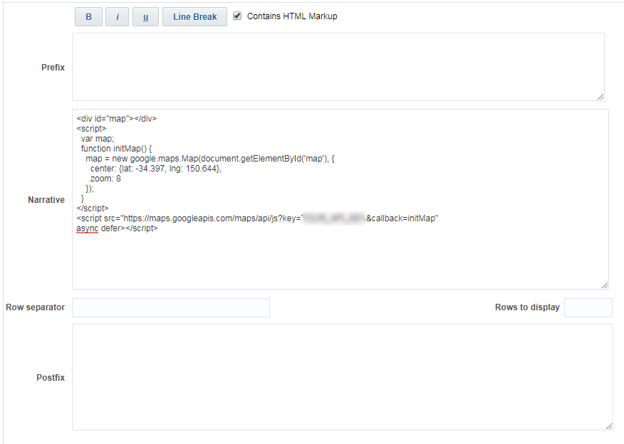
I then proceeded to where it specifies code to put into an OBIEE report narrative
Code
<div id="map"></div>
<script>
var map;
function initMap() {
map = new google.maps.Map(document.getElementById('map'), {

  center: {lat: -34.397, lng: 150.644},

  zoom: 8

});
}
</script>
<script src="https://maps.googleapis.com/maps/api/js?key=YOUR_API_KEY&callback=initMap"
async defer></script>
I inserted this code into a narrative (specifically the narrative section here)
I updated my instanceconfig file to handle CSP errors, but my report remains blank.
Im just trying to get a map to display in my report, and will proceed to play around with it. But I cant even seem to get any map to display at all.
Am I missing something?
Aside from something missing, is this method of using google maps in a narrative also "not recommended"?
As I see a lot of people talk about going through mapviewer.
Not quite sure what is the "best" or recommended way of doing things